We close blind spots in intelligence
Detect hidden activity. Track behaviour over time. Verify ground truth independently.
Temperature shows behaviour
We turn thermal signatures into operational intelligence so you can:
- 01
Detect hidden activity

- 02
Track behaviour over time

- 03
Verify operational status

- 04
Identify stress and emerging risks


Constellr Missions
See how thermal intelligence closes critical gaps in real-world missions.
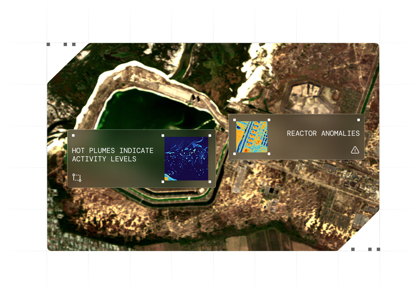
MISSION 1:National Security
A nuclear power plant loses power and switches to backup generators. Optical imagery can't tell which systems are working and which aren't. Crisis teams cannot determine whether cooling systems are functioning properly or if the site is facing imminent failure.
- Clear temperature separation between active and inactive cooling systems.
- Uneven heating distribution across generator blocks.
- Emerging thermal anomalies in critical infrastructure zones.
Crisis teams verify which systems operate and identify load imbalances before failure occurs. Independent assessment without relying on unconfirmed reports.
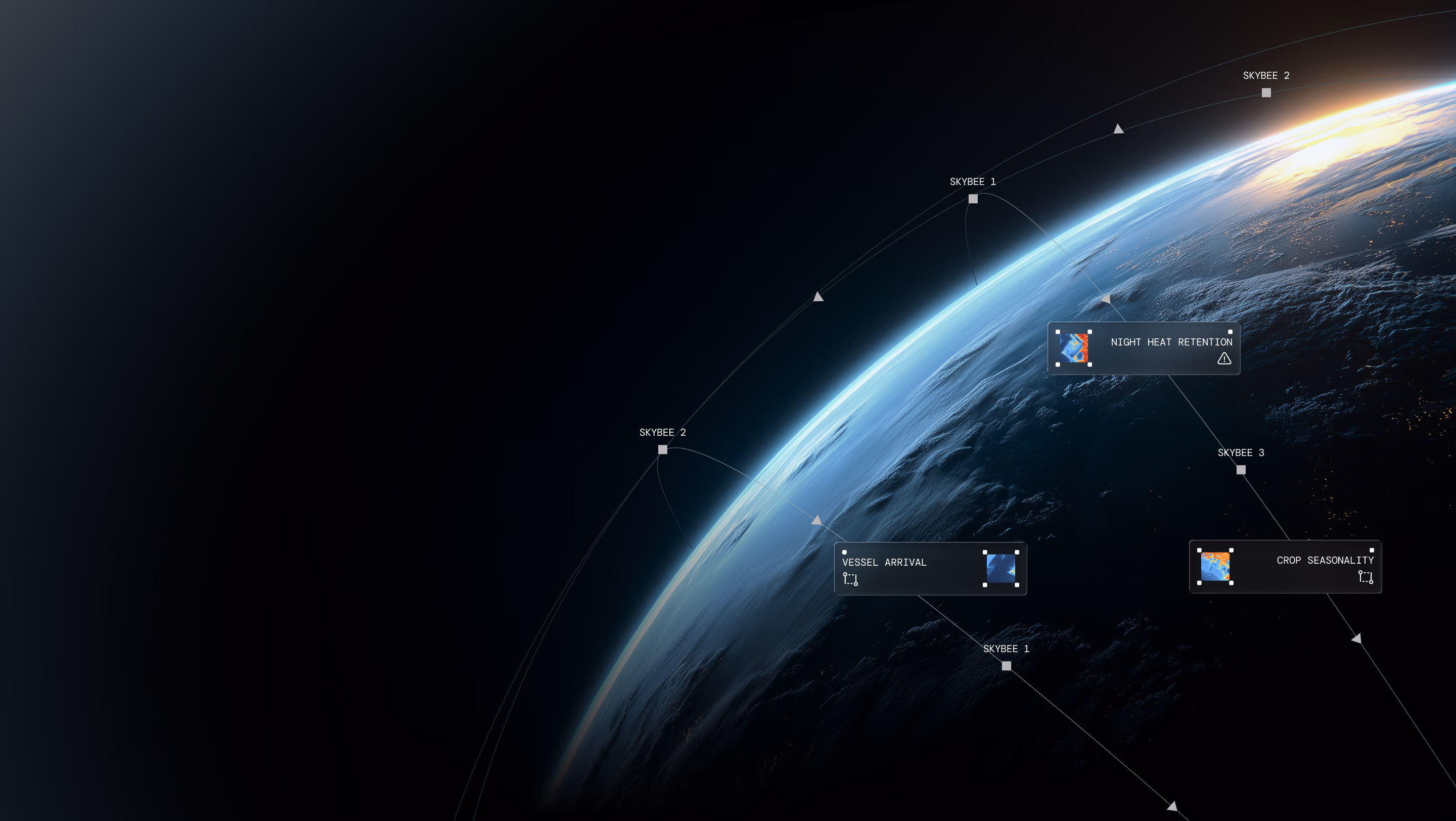
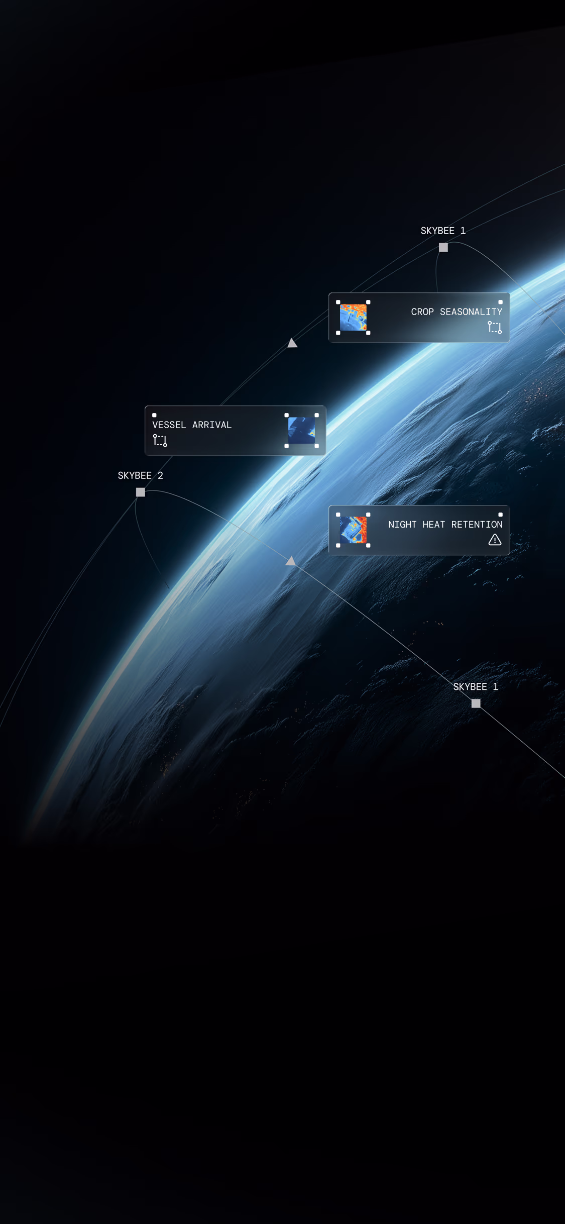
MISSION 2:Maritime Awareness
A vessel can turn off its tracking signal and engage in illegal activity. Optical and radar satellites show the vessel's current location, but not the direction it is heading, the engine activity, or its status at night (especially if radar jamming equipment is being used). Thus, authorities cannot determine whether to intercept, monitor, or ignore the vessel.
- A distinct thermal wake pattern across the water surface indicating the direction the vessel came from and is heading.
- Temperature gradients along the vessel's path.
- Complete movement history from a single capture.
- Active status of vessel operations systems.
Authorities reconstruct vessel trajectory and track behaviour without Automatic Identification System (AIS). Single thermal capture provides more intelligence than multiple optical images. Anticipations of maritime movements become possible and unlock actionable situational awareness for maritime security decisions.
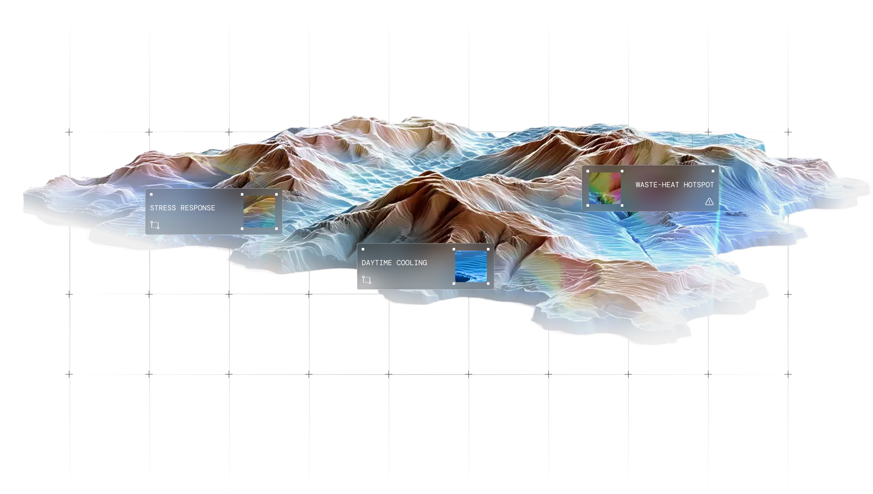
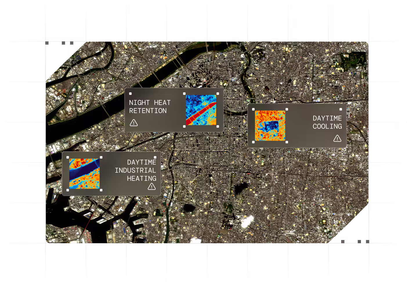
MISSION 3:Urban Dynamics
Urban teams need to identify which districts overheat at night and where cooling systems are struggling. Optical satellites show buildings, not behaviour. Teams cannot prevent heat-related health crises, optimise energy infrastructure, or effectively target emergency resources.
- Temperature hotspots in urban districts during nighttime hours.
- Thermal variation patterns between day and night cycles.
- Stable temperature zones in green-space areas.
Teams identify districts that require cooling infrastructure and zones with heat-vulnerable populations. Planning shifts from reactive to preventive. Climate-risk mitigation becomes data-driven.
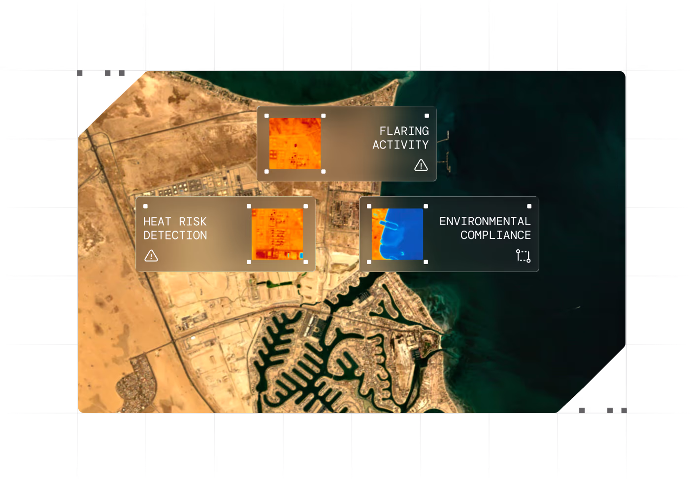
MISSION 4:Industrial Monitoring
A large industrial complex has equipment overheating across the site. Visual inspections can't catch problems fast enough. Machinery can break down without warning, resulting in operational downtime and safety hazards.
- Localised temperature elevation on rooftops and machinery.
- Temperature differences between operational zones.
- Progressive thermal stress patterns in equipment.
Operators identify overheating equipment before failure and target maintenance to high-risk zones. Operational risk is reduced through early intervention. Issues get addressed before they become critical.
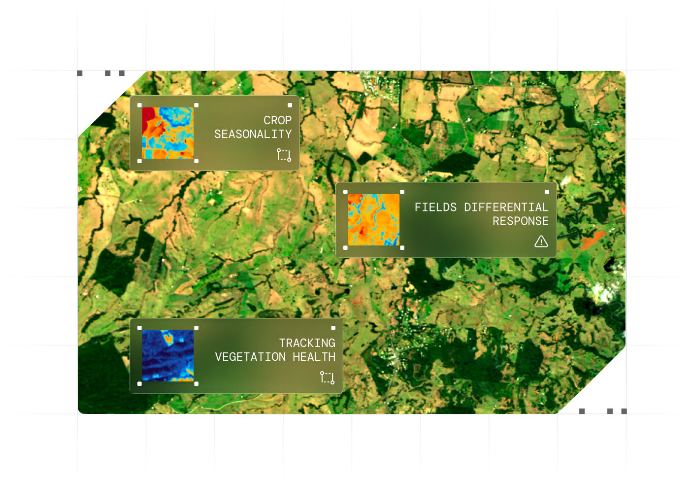
MISSION 5:Food & Water Security
Crops need water at the right time. By the time optical satellites show brown fields, it's too late to save them. Entire harvests die, water gets wasted on fields that don't need it, and farmers lose money.
- Temperature differences between field sections.
- Thermal signatures indicating moisture levels.
- Rapid temperature changes occur across the growing season.
Authorities detect crop stress weeks before visible signs appear. Water management targets fields needing intervention. Yields stay protected, and resource loss is reduced through early action.
Contact us
Act faster. See deeper. Decide with confidence.
Ready to close your blind spots?